City of Brampton Logo

Cycling in Brampton

Riding in Brampton

​​​​​​​​​​​​​​​​​​​​​​​​​​​​​​​​​​​​​​​​​The Brampton Bike Loop

The City is installing bike lanes and paths to connect the Etobicoke Creek, Esker Lake and Chinguac​ousy recreational trails, creating a 40 kilometre trail loop.​ This effort will link a number of neighbourhoods and key destinations in the City to help encourage recreational and everyday cycling trips.

Featured Recreational Trails​

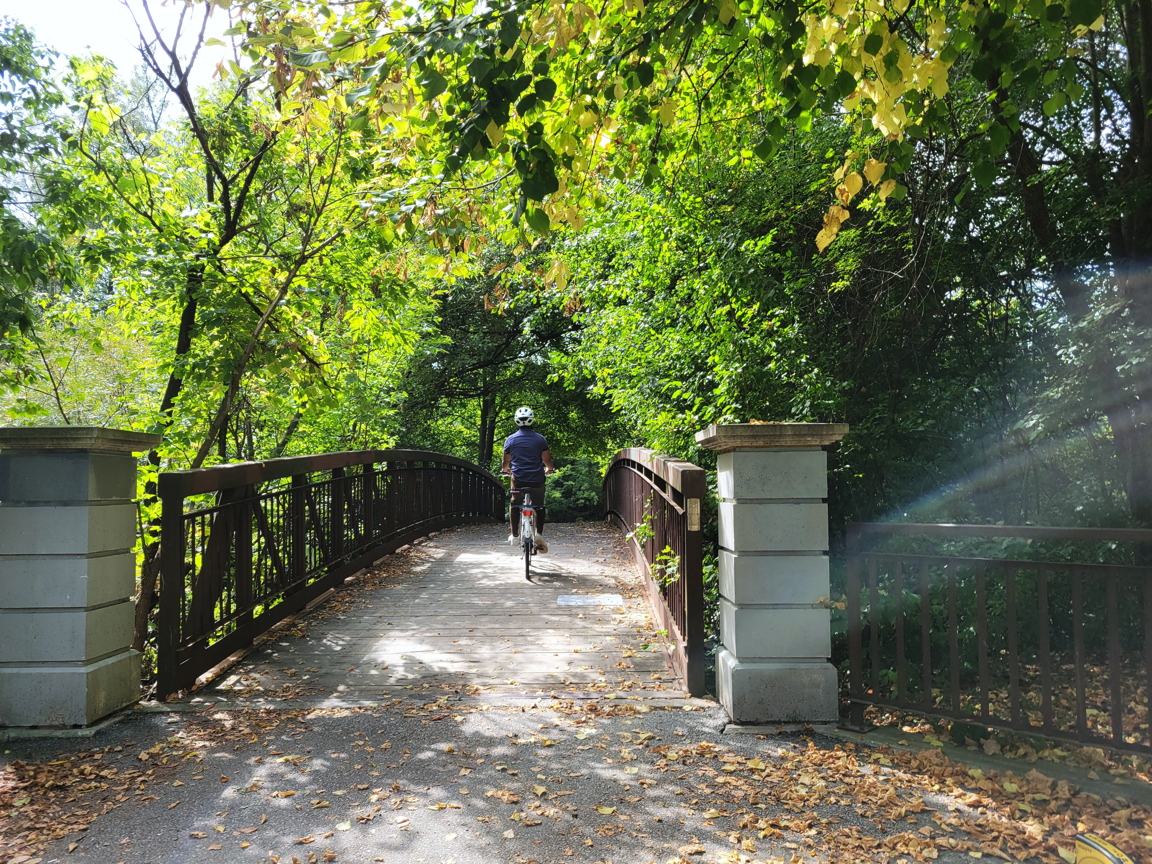
Bike along Brampton’s major recreational trails offering over 100 kilometres of guided and paved recreational trails throughout the City. Look for wayfinding signs along your route, and plan time to stop for new discoveries and adventures.

  • The ​Etobicoke Creek Recreational Trail — the longest recreational trail in Brampton — extends nearly 19 kilometres between the City’s southern and northern boundaries. Following the creek through parks, urban forests and wildflower fields, this recreational trail has few road interruptions, allowing for long and peaceful excursions.​ Take the underpasses through to Caledon and Mississauga.​​

  • The Chinguacousy Recreational Trail winds through several Brampton neighbourhoods, from Victoria Park in Bramalea extending 10 kilometres north to Dixie Road and Countryside Drive. While traveling this recreational trail, you will visit a stretch of suburbs, green spaces and local urban attractions.

  • Don Doan Recreational Trail (formerly known as Professor's Lake Recreational Trail); is a predominantly suburban recreational trail that takes you through the east side of Bramalea neighbourhoods. Wayfinding signs navigate you approximately 11 kilometres north to Brampton’s popular beach and public swimming area, Professor’s Lake.

  • Esker Lake Recreational Trail takes you into some of the City’s most treasured parks, green spaces and conservation areas, showcasing nature’s best. Plan a couple of hours​ or make a full day of it, with many options for activities en route, both urban and wild.


The colourful, artistic mural on the su​rface of the Franceschini Bridge is the first of its kind, unveiled by the City of Brampton in 2018. A once abandoned road crossing has been reimagined as a recreational trail link for​ cyclists and pedestrians, connecting the Esker Lake Recreational Trail across Highway 410, for safe and easy access.​​​​​​​​​​​​​​​​​​​​​​​​​

Biking Facilities in Brampton

The City is building a network of well-connected bike lanes and recreati​onal trails that will make travel by bike a safe and desirable option for school, work, recreation, and other trips. Here are some examples of existing and future types of bike facilities you will find in Brampton.​​

Bike Lane

Bike lanes are lanes dedicated exclusively for use by cyclists through a combination of pavement markings and signage. Bike lanes are most appropriate on collectors or minor arterial roads, depending on the speed and volume of traffic.​

​​

Bike Signals

Separate signal heads for cyclists are provided for some cycling facilities, depending on the location and phasing requirements of cyclists. The signals are recognizable from other traffic signals by the bike symbol.

​​
​​

Crossrides

Crossrides allow cyclists to stay on their bikes while crossing through intersections. They are located where multi-use paths cross a road. Crossrides are identified with a line of painted squares on both sides of the crossing, and may also include painted bicycle marks.

When you’re riding your bike:

  • If the intersection has bicycle signals, look for a cyclist pushbutton. If there is a button, push it and wait until the bicycle signal is green.
  • Ride cautiously across the intersection within the crossride. Watch for left- and right-turning vehicles to be sure they see you and are yielding.
  • Travel at a speed that allows you to stop quickly if a vehicle turns across your path.
  • Don’t pass other cyclists within the crossride. If pedestrians are crossing, ring your bell to let them know you are approaching and pass carefully.
  • By law, cyclists must yield to pedestrians on multi-use trails.

If you are driving a vehicle:

  • When making a turn, look for cyclists and pedestrians who are approaching or crossing the intersection.
  • Signal your turn early, giving other road users time to react.
  • Check your blind spot before turning.


​​

Cycle Tracks

Cycle tracks (also referred to as protected bike lanes or separated bike lanes) are enhanced cycling facilities that provide some form of physical protection between cyclists and moving cars – it could be bollards, curbs, or parked cars, as examples. Cycle tracks are most appropriate on arterial roads, depending on the speed and volume of traffic.​

​​

Multi-use Path

Multi-use paths are located off-road, either in the boulevard of a roadway or through land without any roads. Both pedestrians and cyclists can use these facilities, and pavement markings and signage can help to clarify how users should share the path.​

​​

Urban Shoulder

Urban shoulders are the same width as a bicycle lane, but are not used just for bicycles – they can also be used for on-street parking. Urban shoulders are typically implemented as an interim measure to provide a local cycling connection to area schools, businesses, trails and recreation centres. Once an overall connected cycling network is established, these urban shoulders can easily be converted into designated bicycle lanes.​

​​

Solid line Bike Lane at IntersectionDashed line Bike Lane at Intersection

Bicycle lanes are reserved for people on bikes. They are typically marked by a solid white line and a bicycle symbol. 

If you are driving a vehicle, you may sometimes need to enter or cross a bicycle lane to turn right at an intersection or driveway. Take extra care when you do this. 

  • Watch for cyclists' hand signals. A cyclist may indicate a right-hand turn by extending their right arm.
  • Try to make eye contact when possible with cyclist
  • When turning right, signal and check your mirrors and the blind spot to your right to make sure you do not cut off a cyclist.
  • Enter the bike lane only after ensuring that you can do so safely, and then make the turn.
  • For bike lanes that have a solid line extending to the intersection, vehicles are not allowed to enter the bike lane and must yield to cyclists before they can complete their right turn. 
  • For bike lanes that have a dashed line leading to the intersection, drivers are allowed to enter the bike lane when it is safe and clear of cyclists. Cyclists must then pass the turning vehicle on the left or wait behind the vehicle until the lane is clear.


​​​​

Bike Queue Box

Certain intersections in Brampton have green “bike boxes,” which allow cyclists to proceed ahead of vehicles when the traffic signal turns green. 

When you’re riding your bike, position yourself in the green queue box to the left, centre, or right, depending on where you are headed,  and remember to signal your turn if making one.

On a red light:

  • Bicycles stop in the green box 
  • Cars stop behind the white line

When light turns green:

  • Bicycles go first
  • Right-turning cars, check for bicycles before turning


Yeild to Transit Sign

Buses are allowed to stop in a bike lane briefly at transit stops. When riding in a bike lane approaching a stopped bus that is loading and/or unloading passengers, you must yield the right-of-way to the bus. Do not attempt to pass the bus on its right-hand side until it has completely cleared the bike lane. ​

​​​